


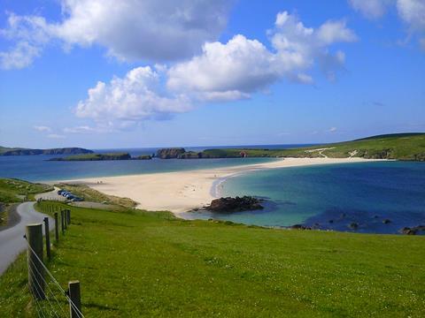
Shetland has published Scotland’s first regional marine plan, setting out how the islands’ waters will be managed to support local communities, safeguard wildlife and respond to climate change.
Covering activities up to 12 nautical miles from shore, the Shetland Islands Regional Marine Plan provides a detailed framework for decisions on everything from aquaculture to renewable energy development.
“The Shetland Islands Regional Marine Plan ensures Shetland’s unique character and the importance of the marine environment to the islands’ economy, culture and way of life is recognised in the marine planning process,” explained Dr Rachel Shucksmith of the Shetland Islands Marine Planning Partnership.
“It is built on a strong base of local evidence, gathered through collaboration with the Shetland community, industry partners and local organisations.”
Developed by the Shetland Islands Marine Planning Partnership, the plan is the product of extensive community input and years of local evidence-gathering.
Its guidance covers climate assessments for new developments, protections for sensitive habitats such as maerl and horse mussel beds and requirements for developers to consider impacts on communities and wildlife before projects progress.
It also emphasises ensuring that aquaculture and offshore renewables deliver meaningful benefits for island residents.
“Shetland has a rich maritime heritage and its seas are vital to the local economy, culture and way of life,” said Cabinet Secretary for Climate Action and Energy Gillian.
“This plan demonstrates how local knowledge and national priorities can work together to protect the marine environment whilst, crucially, supporting our island communities to thrive. Shetland’s approach to marine planning sets a strong example for sustainable development across Scotland.”