



ORBIMAGE Inc. are offering subscribers an update, version 5.5, of their image processing software, OrbMap™, part of SeaStar Fisheries Information Service. Greg Hammann, senior director of oceanographic solutions said "OrbMap v5.5 allows fishing captains to see a level of detail in our plankton maps that was not possible before," a company press statement said.
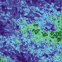
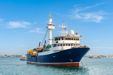
The new data processing and compression algorithms within OrbMap make it possible to view plankton data files with 250 colour levels and permit the same data manipulation as they skippers have enjoyed with other satellite oceanographic data types, the statement said. ORBIMAGE's SeaStar Service is used by tuna and sardine purse seiners, pelagic longline and Albacore trolling vessels and mid-water trawling vessels worldwide, the statement said. By combining local knowledge with the oceanographic satellite data layers available in the SeaStar Service, captains can make informed decisions on where to find fish, Orbimage claims.
The update offers the ability to: calculate plankton contours; to display the data in full colour or as 'filled contours'; to adjust the colour scale between your selection of minimum and maximum values; to overlay the plankton contours on top of other image data such as sea surface temperature and sea surface height anomaly data.
The statement said OrbMap v5.5 software is provided free to subscribers to the SeaStar Fisheries Information Service.
There is also improved data compression for SeaStar Maps such as plankton, sea surface temperature, sea surface height anomalies, sub surface temperature and surface currents. Orbimage claims that, as well as allowing a skipper to receive the new plankton maps and 'Find Fish Faster', the update will save money on satellite communication costs because the files have been compressed by 20-30% of their normal size. "We are pleased at the response so far from our customers who have installed the new OrbMap software version", said Chris Wilson, director of marketing and sales. "Our OrbView-2 data is highly regarded by the world's scientists and oceanographers and it is an important part of our suite of oceanographic satellite data provided to fishing companies worldwide," the press release said.
ORBIMAGE says it uses a constellation of digital remote sensing satellites and a worldwide integrated image receiving, processing and distribution network. It operates the OrbView-2 ocean and land, multispectral, imaging satellite, launched in 1997 as well as the new OrbView-3 high-resolution satellite launched on June 26, 2003. The latter offers one-metre, panchromatic (black and white) and four-metre multispectral (colour) digital imagery.