


Compass futures – are there choices?
FOG for clarity?
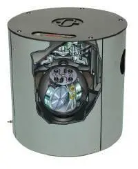
When Fibre-Optic Gyros (FOGs) were introduced in the mid 1990s, it was hoped that this technology, with no moving parts, would result in high accuracy, low prices and zero maintenance as well as more economical operation, rendering regular replacement of gyro spheres, required by conventional gyros, unnecessary.
After a while, however, it became evident that the cost of a FOG was no lower than that of a gyro; rather, it was more than three times as high. Aside from a very costly manufacturing process, material costs, particularly for photoconductors (several kilometres of which are needed), were a burden as their prices did not fall as expected.
There is little experience as yet of maintenance costs for FOGs, as most have been in operation for only a few years. Experts estimate the average life of a fibre optic compass sensor at about 10 years when a complete overhaul by the manufacturer is necessary including an extensive calibration, which has to be carried out at the factory. This is much more difficult and expensive than the replacement of a gyro compass sphere and results in a logistic problem with the FOG sensors required quickly. Hence FOGs run longer but have higher costs.
Regarding accuracy, the FOG is inferior to the traditional gyro. FOGs achieve a dynamic accuracy of 0.7°, thus meeting IMO minimum requirements, but are not a technical improvement in this regard. Conventional gyros achieved an accuracy of 0.4° in the 70s! FOGs have thus rarely been used on commercial vessels. Eight years after its introduction, less than 5% of newbuildings are fitted with FOGs and demand is dwindling.
Arrival of GPS
Meanwhile, compass development did not stand still. In 2002, the ‘GPS compass’ was announced. With this the heading of a ship is determined by two GPS antennas, mounted on a bar, which measure the phase relationship of the satellite signals. The heading is calculated from the difference between measurements, supported by acceleration and speed sensors. Depending on processing quality, antenna arrangement, and calculator algorithms, heading accuracies of better than 1° can be achieved, within the IMO accuracy requirements.
GPS should offer reasonable purchase costs and freedom from maintenance. Today there are GPS compasses which cost just half that of a gyro, but are they an attractive alternative?
Yes, if only there were no reliability considerations. Using a satellite compass means that a vessel’s course is no longer determined by an autonomous on-board sensor, but now depends on external systems and their reliability. There are continual reports of intentional and unintentional interruptions in GPS satellite operations. As yet there is no alternative of equal quality to the US system to improve reliability. The USA continues to reserve the right to cut off selected individual areas from use during times of crisis.
A second satellite system, independent of GPS, would reduce this risk. Initially hopes were pinned on the Russian GLONASS system; for some years there has also been the European project GALILEO. Theoretically the Russian system is available worldwide, but the highest accuracy is achieved only over Russia as the operators have no control over earth stations in the West. GALILEO, however, is intended for worldwide use, but will not be operational until 2012.
If receivers could use two independent satellite systems, there would be real redundancy and the necessary reliability unless the US and Russian operators interfered with or shut out each other for strategic reasons in times of crisis.
Third parties might also interfere with GPS reception, an increasing concern for the US authorities. This ‘jamming’ can be done with small portable transmitters rendering GPS reception over a radius of over 100 kilometres ineffective. However, with low emission power, it is difficult to locate these units.
There is also the risk of interferences from the ship itself. Shadows and reflections from masts, smokestack and deckhouses influence the GPS heading as well as irradiation from other antennas.
Antenna considerations
For reliable GPS headings the antenna must be mounted optimally. GPS signals (1.575GHz) are affected by Inmarsat transmitters, on a frequency of 1.525-1.660 GHz. S-band radars, operating at exactly double the frequency (3.050GHz), can also cause interference.
Ideally the antenna should be located as high as possible. However, limited upper deck area and a constantly growing number of antennas, are a headache for shipyards and service technicians.
For normal radios and position receivers such disturbances might be acceptable. Heading, however, is a different matter. Disturbances are fatal as they take immediate effect. Autopilots react to every change in course and instigate an immediate turn. Thus the GPS compass is not acceptable, under SOLAS and IMO regulations, as the main navigational heading source, for large ships.
Meanwhile, gyro research has not remained static, and has been continually refined – ‘quick settling’ and ‘automatic error correction’ are now standard, while parts subject to mechanical wear have been largely replaced with long-life electronics and optical transmission technology. Instead of requiring annual overhauls, modern gyros now need no maintenance for at least three years.
The gyro remains the first, most reliable and most accurate source of a ship’s heading.