
AI and satellite tech reveals titanic at-sea activity growth
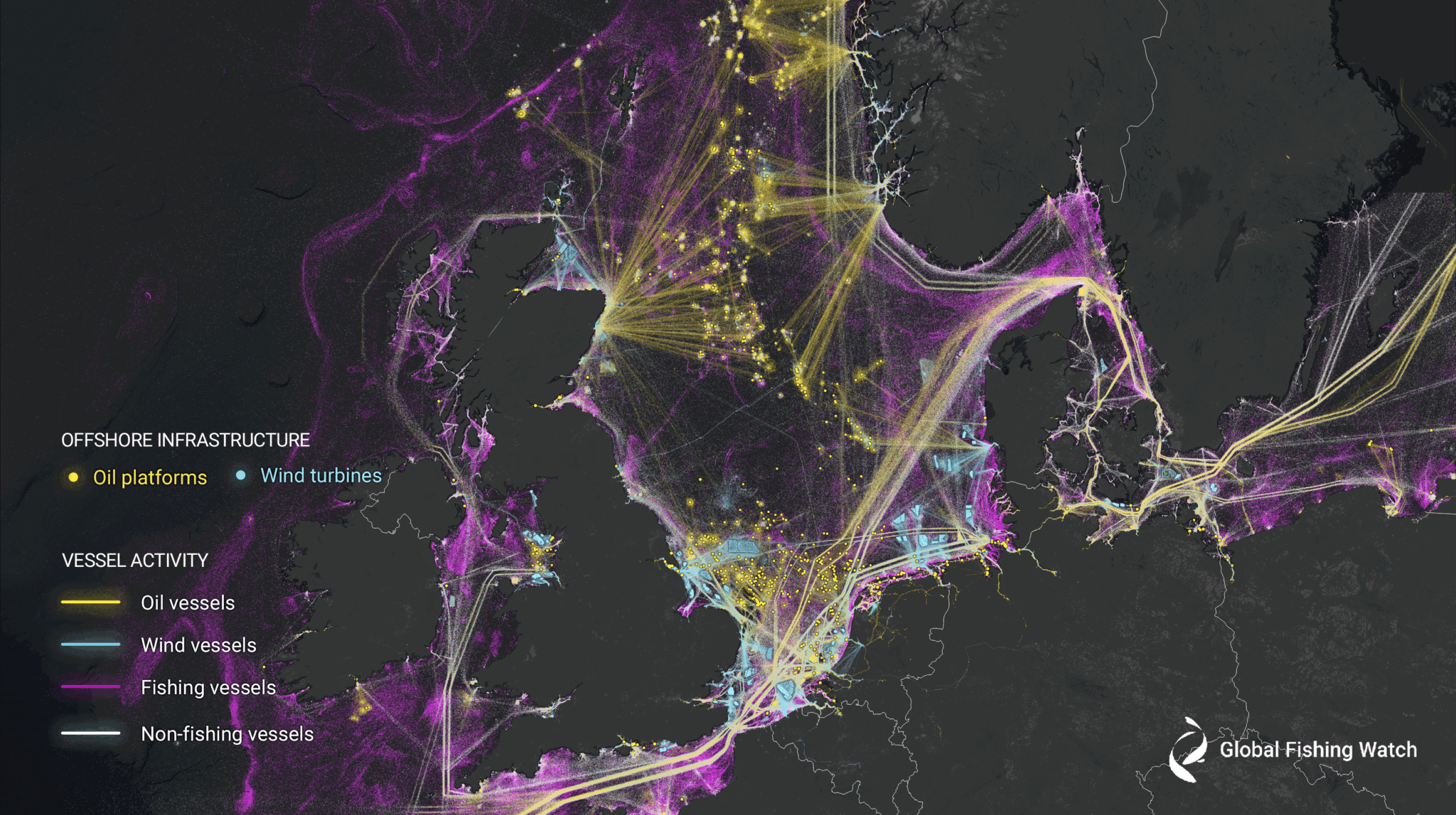
Using machine learning and satellite imagery to create the first global map of large vessel traffic and offshore infrastructure, a new study led by Global Fishing Watch has found a significant amount of activity that was previously dark to public monitoring systems.
Researchers from Global Fishing Watch, the University of Wisconsin-Madison, Duke University, UC Santa Barbara and SkyTruth analysed 2 million gigabytes of satellite imagery spanning 2017-2021 to detect vessels and offshore infrastructure in coastal waters across six continents where more than three-quarters of industrial activity is concentrated.
Synthesising GPS data with five years of radar and optical imagery, the researchers were able to identify vessels that failed to broadcast their positions. Using machine learning, they then concluded which of those vessels were likely engaged in fishing activity.
“A new industrial revolution has been emerging in our seas undetected – until now,” Global Fishing Watch Director of Research and Innovation and co-lead author of the study David Kroodsma said. “On land, we have detailed maps of almost every road and building on the planet. In contrast, growth in our ocean has been largely hidden from public view. This study helps eliminate the blind spots and shed light on the breadth and intensity of human activity at sea.”
Unprecedented mapping
Co-lead author and Global Fishing Watch Senior Machine Learning Engineer Fernando Paolo explained that historically, vessel activity has been poorly documented, which has limited the understanding of how the ocean is being used.
“By combining space technology with state-of-the-art machine learning, we mapped undisclosed industrial activity at sea on a scale never done before.”
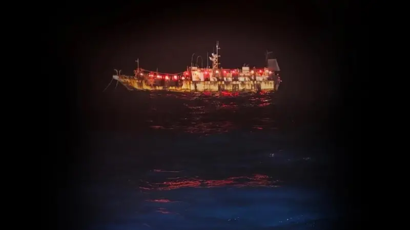
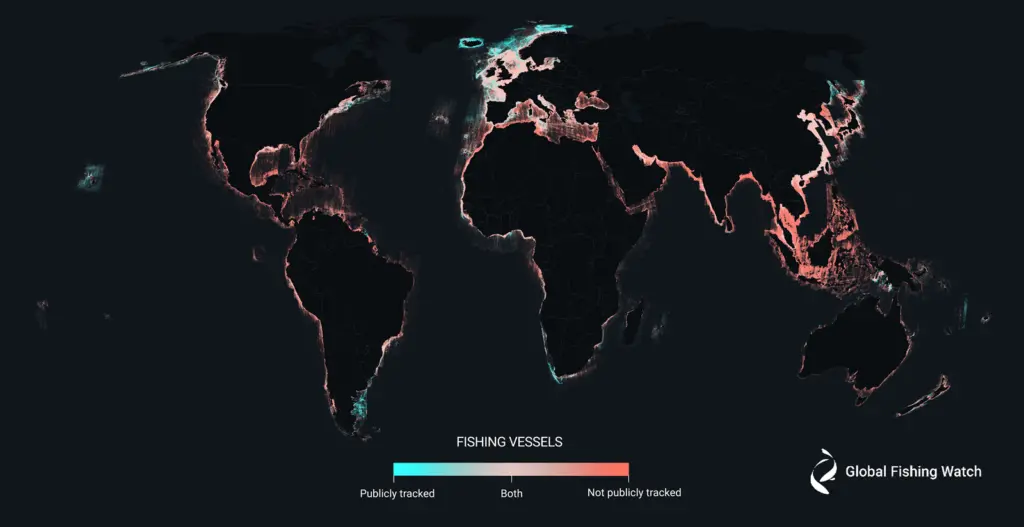
Global Fishing Watch also noted that while not all boats are legally required to broadcast their position, vessels absent from public monitoring systems – often termed “dark fleets” – pose major challenges for protecting and managing natural resources.
It said the researchers found numerous dark fishing vessels inside many marine protected areas, and a high concentration of vessels in many countries’ waters that previously showed little-to-no vessel activity by public monitoring systems.
“Publicly available data wrongly suggests that Asia and Europe have similar amounts of fishing within their borders, but our mapping reveals that Asia dominates – for every 10 fishing vessels we found on the water, seven were in Asia while only one was in Europe,” University of Wisconsin-Madison Assistant Professor of Natural Resource Economics Jennifer Raynor said. “By revealing dark vessels, we have created the most comprehensive public picture of global industrial fishing available.”
A free resource
The study also shows how human activity in the ocean is changing. Coinciding with the Covid-19 pandemic, fishing activity dropped globally by about 12%, with an 8% decline in China and a 14% drop elsewhere. In contrast, transport and energy vessel activity remained stable.
Offshore energy development surged during the study period. Oil structures increased by 16%, while wind turbines more than doubled. By 2021, turbines outnumbered oil platforms. China’s offshore wind energy had the most striking growth, increasing ninefold from 2017 to 2021.
“The footprint of the Anthropocene is no longer limited to terra firma,” Duke University Professor of Marine Geospatial Ecology Patrick Halpin said. “Having a more complete view of ocean industrialisation allows us to see new growth in offshore wind, aquaculture and mining that is rapidly being added to established industrial fishing, shipping and oil and gas activities. Our work reveals that the global ocean is a busy, crowded and complex industrial workspace of the growing blue economy.”
According to the researchers, the open data and technology used in the study can help governments, researchers and civil society to identify hotspots of potentially illegal activity, determine where industrial fishing vessels may be encroaching on artisanal fishing grounds, or simply better understand vessel traffic in their waters.
“Previously, this type of satellite monitoring was only available to those who could pay for it. Now it is freely available to all nations,” Kroodsma said. “This study marks the beginning of a new era in ocean management and transparency.”
The study was supported by Bloomberg Philanthropies, National Geographic Pristine Seas and Oceankind, and technology partner Google.